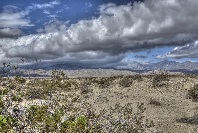
Every now and then when you're out geocaching, you see some pretty interesting sites. The nice thing about where I live is it's only a 30 minute drive to get to the desert, or the beach. For this shot, it was obviously, the desert. And the nice thing about the desert is the wide open spaces. Once you get out of any town, you have some pretty scenic vistas.
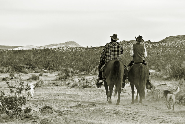
Several years ago, I was out taking some shots of the mountains with Joshua Trees in the foreground, when I heard these two guys conversing on horseback. One of their dogs came up to greet me, giving my hand a lick. We exchanged pleasantries and then they rode off and I took some photos of them as they rode away from me.
It literally wasn't until I looked at the shot on my computer screen that I realized the guy on the right was packing. The way this scene played out, I just felt this one needed a slight sepia treatment to it to give it an "Old West" feel to it. And the only thing that really gives this away is the guy on the left is wearing sneakers. Otherwise, it could be something form the 1800s.
Comments would be appreciated. Thanks for stopping by.
A photo a day... is a blog about my musings on life and the little things I observe on a regular basis. I might not post every day. In fact, I'm positive I won't post every day, but I would like to post at least twice a week, if not more. Photos will accompany each new post. Please, as always, feel free to comment if you have questions or if you just want to comment. Feel free to disagree. Let's keep it civil and get along is all I ask in return.
Showing posts with label desert. Show all posts
Wednesday, January 24, 2018
Dogz and horses on walkz
Labels:
animals,
desert,
dog,
Dogz on Walkz,
geocaching,
horses,
old west
Wednesday, April 1, 2015
Photo Blogging Challenge (March 2015): Two
Once again, P.J. has posted his blogging challenge. This month, the theme was two, in honor of this challenge going on for two years. Last year, I thought I did fairly well when the theme was one. This year, I felt like I scrambled, which is usually the case, but here, once again, I'm posting March's theme on the first day of April, apparently a day late and a dollar short. For whatever reason, I kept thinking that I still had another day, but that wasn't the case as March has already disappeared and it is indeed April. So, without further ado, I give you the month of March's Twos.
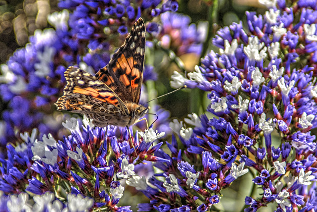
1. Two antennae
Although, you'll have to look closely at this one to see the second one. Look at the nose of the butterfly and you'll see what looks like a yellow bulb, the second antenna slightly out of focus. I love taking photos of butterflies and have been known to stalk them for hours trying to get a decent shot of any that come in range. Several years ago, I learned the main differences between moths and butterflies. Most people will say butterflies are colorful and moths aren't, but that's not necessarily the case. The big differences are two-fold. One, butterflies are out during the day while moths are out at night. Second deals with their antennae. A butterfly's antenna is smooth with a round bulb at the end, while a moth's antenna tends to look feathery.
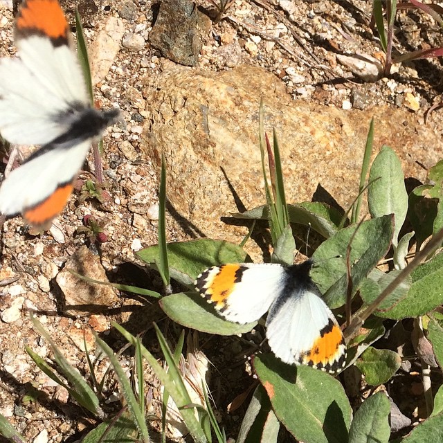
2. Two butterflies
Oh boy, here we go with an entire series of butterfly shots. No, but I like this photo for a variety of reasons. First off, it was taken with my iPhone. While not the greatest photo in the work, I've been fairly impressed with the lens on this phone and I understand the lens on the iPhone6 is even better. The second reason I like this shot is this is a new butterfly species for me. These are Pacific Orange Tips. I would suspect the one in the upper left hand corner is probably a male since it was pestering the other one to no end. Either that, or it was defending its territory for some reason. I took this shot, while geocaching, up in the newly created San Gabriel Mountains National Monument.
The national monument is still being administered by the U.S. Forest Service, and thus, geocaching is still allowed in the monument. I can imagine sometime in the future, if the National Park Service (NPS) takes over administration of this park, the geocaches will have to be removed. I understand why the NPS takes the stand that it does, since it views geocaches as litter, but they also seem to be more open to geocaching, which I think is a good thing. Time will tell on this one. And ironically, I was out hiking a couple of weeks later in the Simi Valley area and spotted another Orange Tip there. I guess, once, you see one, they decide they don't have to hide from you any more.
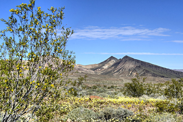
3. Two peaks
I'm in the middle of my second week of Spring Break. At the beginning of the first week, I went camping with my friend in Death Valley National Park, where this shot was taken. We were actually geocaching all three days. "But wait a minute," you say. "I thought geocaching wasn't allowed in national parks?" This is true, but there are certain types of caches, virtual caches and earth caches that are allowed, because they don't have any physical container, to litter up the landscape. Virtual caches take you to a place and you have to answer a couple of questions about the particular place. Earth caches are geology based virtual caches where you also have to answer some questions based upon the geology found in that spot. It's a more specialized type of virtual in a way.
These two peaks, of which I have no names for them, are in the Greenwater range in the southern part of Death Valley. The wildflowers were pretty much spent down at the lower elevations, but here at around 2500 feet or so above sea level, there was still a profusion of blooms. Desert mallow, mesquite and five spot mallow were all to be seen in abundance at this site and others as we traveled into the park. Once we got further down in elevation, we stopped see a whole lot of any kind of vegetation, as the park is pretty stark.
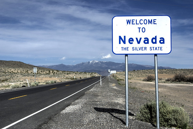
4. Two states
Part of the allure of geocaching has always been that it takes me places I might not go just because. Just over that rise is Pahrump, Nevada and just down to the right off the edge of the photo there is a geocache that hidden out there. That particular cache was the first cache I've ever found in Nye County, Nevada. It might not mean much to you, but I think it's kind of cool when I find caches in new places I've never been before. I can guarantee you that unless I had family living in Pahrump, I would have never visited there.
I've found geocaches in 8 different states. I've found a geocache in every county in California. Am I nuts? Probably. But, the silly game keeps me out of trouble for the most part and I've made some very good friends who have a like-minded interest in being outdoors and using billion dollar satellites to find pieces of Tupperware hiding in the wilderness.
5. Two different systems
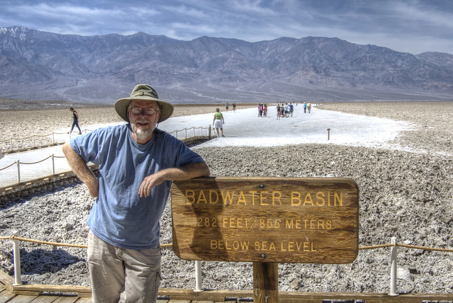
I can remember way back in the 70s when there was a push for the United States to go metric. Everything started getting printed in both feet and meters or miles and kilometers. That's where we went wrong. If we are ever going to convert to the metric system, which by the way, is one of the most logical systems there is, then we have to jump in with both feet and don't turn back. And the government is going to have to lead the way.
All the government would have to do is to stop posting signs in two different systems. Why do we need to know that Badwater is 282 feet below sea level? Isn't it enough that we know that it's the lowest point in the western hemisphere? If the sign just read 85.5 meters below sea level, people would get the point. Eventually, the "Old Schoolers," the ones who complain about anything and everything would eventually die out and everyone who has ever lived wouldn't know any better and we'd all just use the metric system. Do you need to know the temperature in Fahrenheit? No, not really. Celsius is actually pretty easy to use. If it's in the 10s, it's cold. If it's in the 20s, it's pretty mild, while the 30s is getting pretty warm. 40s? Yeah, that's where Death Valley is in the summertime, most of the time. Death Valley is also a big draw in the summertime, especially for Europeans. Why? It's one of the few places that can hit 50 degrees. That would be 122 for us non metric people.
So there you have it. Another month of photos dedicated to the number 2. Please stop by P.J.'s page here to view other's interpretations of the theme Two.
1. Two antennae
Although, you'll have to look closely at this one to see the second one. Look at the nose of the butterfly and you'll see what looks like a yellow bulb, the second antenna slightly out of focus. I love taking photos of butterflies and have been known to stalk them for hours trying to get a decent shot of any that come in range. Several years ago, I learned the main differences between moths and butterflies. Most people will say butterflies are colorful and moths aren't, but that's not necessarily the case. The big differences are two-fold. One, butterflies are out during the day while moths are out at night. Second deals with their antennae. A butterfly's antenna is smooth with a round bulb at the end, while a moth's antenna tends to look feathery.
2. Two butterflies
Oh boy, here we go with an entire series of butterfly shots. No, but I like this photo for a variety of reasons. First off, it was taken with my iPhone. While not the greatest photo in the work, I've been fairly impressed with the lens on this phone and I understand the lens on the iPhone6 is even better. The second reason I like this shot is this is a new butterfly species for me. These are Pacific Orange Tips. I would suspect the one in the upper left hand corner is probably a male since it was pestering the other one to no end. Either that, or it was defending its territory for some reason. I took this shot, while geocaching, up in the newly created San Gabriel Mountains National Monument.
The national monument is still being administered by the U.S. Forest Service, and thus, geocaching is still allowed in the monument. I can imagine sometime in the future, if the National Park Service (NPS) takes over administration of this park, the geocaches will have to be removed. I understand why the NPS takes the stand that it does, since it views geocaches as litter, but they also seem to be more open to geocaching, which I think is a good thing. Time will tell on this one. And ironically, I was out hiking a couple of weeks later in the Simi Valley area and spotted another Orange Tip there. I guess, once, you see one, they decide they don't have to hide from you any more.
3. Two peaks
I'm in the middle of my second week of Spring Break. At the beginning of the first week, I went camping with my friend in Death Valley National Park, where this shot was taken. We were actually geocaching all three days. "But wait a minute," you say. "I thought geocaching wasn't allowed in national parks?" This is true, but there are certain types of caches, virtual caches and earth caches that are allowed, because they don't have any physical container, to litter up the landscape. Virtual caches take you to a place and you have to answer a couple of questions about the particular place. Earth caches are geology based virtual caches where you also have to answer some questions based upon the geology found in that spot. It's a more specialized type of virtual in a way.
These two peaks, of which I have no names for them, are in the Greenwater range in the southern part of Death Valley. The wildflowers were pretty much spent down at the lower elevations, but here at around 2500 feet or so above sea level, there was still a profusion of blooms. Desert mallow, mesquite and five spot mallow were all to be seen in abundance at this site and others as we traveled into the park. Once we got further down in elevation, we stopped see a whole lot of any kind of vegetation, as the park is pretty stark.
4. Two states
Part of the allure of geocaching has always been that it takes me places I might not go just because. Just over that rise is Pahrump, Nevada and just down to the right off the edge of the photo there is a geocache that hidden out there. That particular cache was the first cache I've ever found in Nye County, Nevada. It might not mean much to you, but I think it's kind of cool when I find caches in new places I've never been before. I can guarantee you that unless I had family living in Pahrump, I would have never visited there.
I've found geocaches in 8 different states. I've found a geocache in every county in California. Am I nuts? Probably. But, the silly game keeps me out of trouble for the most part and I've made some very good friends who have a like-minded interest in being outdoors and using billion dollar satellites to find pieces of Tupperware hiding in the wilderness.
5. Two different systems
I can remember way back in the 70s when there was a push for the United States to go metric. Everything started getting printed in both feet and meters or miles and kilometers. That's where we went wrong. If we are ever going to convert to the metric system, which by the way, is one of the most logical systems there is, then we have to jump in with both feet and don't turn back. And the government is going to have to lead the way.
All the government would have to do is to stop posting signs in two different systems. Why do we need to know that Badwater is 282 feet below sea level? Isn't it enough that we know that it's the lowest point in the western hemisphere? If the sign just read 85.5 meters below sea level, people would get the point. Eventually, the "Old Schoolers," the ones who complain about anything and everything would eventually die out and everyone who has ever lived wouldn't know any better and we'd all just use the metric system. Do you need to know the temperature in Fahrenheit? No, not really. Celsius is actually pretty easy to use. If it's in the 10s, it's cold. If it's in the 20s, it's pretty mild, while the 30s is getting pretty warm. 40s? Yeah, that's where Death Valley is in the summertime, most of the time. Death Valley is also a big draw in the summertime, especially for Europeans. Why? It's one of the few places that can hit 50 degrees. That would be 122 for us non metric people.
So there you have it. Another month of photos dedicated to the number 2. Please stop by P.J.'s page here to view other's interpretations of the theme Two.
Labels:
butterfly,
Death Valley,
desert,
geocaching,
metric system,
national parks
Saturday, February 28, 2015
Photo Blogging Challenge (February 2015): Winter
So after blogging 23 times in January, I've fallen into my same old habit again, as this is only my fourth post of the month. And the first three were written in the first two weeks of the month. So much for good intentions.
P.J.'s Photo blogging challenge for this month was winter. Quite a few people have participated this month as I note 11 other links, plus P.J.'s own contribution to the challenge. I guess I'll be lucky number 13.
As always, winter in Southern California means something different than the rest of the country. Snow, maybe at higher elevations, but nothing here. We got a couple of days of rain in February, the latest being yesterday. It's been cold all day today, but nothing like people back east have been having. 50 degrees here would probably be a nice spring day back east.
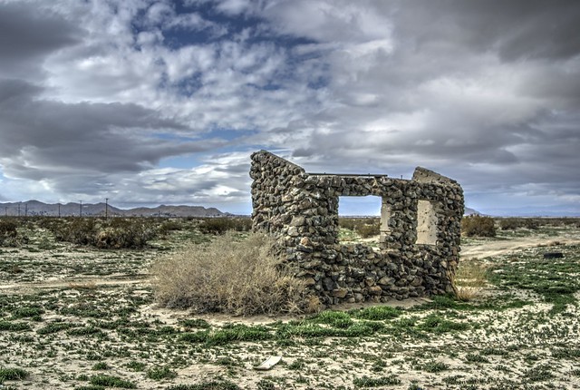
With the nice weather, I don't have a bunch of "wintery" shots to show you. I went on a couple of nice hikes this month while out geocaching. Found some interesting abandoned buildings while out on the hike and so I thought I'd show you those.
Usually, when I write this particular blog piece, I write about individual photos, but this time, I may just keep a string of consciousness going on this one as most of the shots are very similar. The first two shots were taken while I went on a hike out in the desert north of where I live. These are included in here, mainly because both of them were accepted into the Project Weather Flickr page. Project Weather is linked up with the Yahoo Weather App. The photos that are accepted into Project Weather are then featured on the Yahoo Weather App. The first one is linked to Wilsona, CA, which means the next time it's cloudy in Wilsona, my shot could shoe up in someone's feed who happens to be looking at the weather in Wilsona. I currently have 29 of my shots in Project Weather. I see mine occasionally show up when I look at the weather for my local area since most of the shots were taken around here. I do have some that show up in other areas, particularly Grand Canyon and Bryce Canyon National Parks. The nice thing is if someone sees the shot, they can click on a small link at the bottom of the shot and the app will take the user back to my Flickr page. A little exposure never hurt anyone I guess.
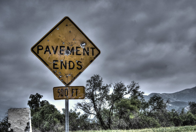
Last weekend, the weather was cool, but there wasn't a threat of rain, so I went out geocaching again. I picked an area that looked fairly isolated, someplace that I hadn't been to before. What that usually means is there quite a few caches I haven't found. At one point, while searching out sites on Google maps, I spotted this area that was a paved road that turned into a dirt road. I could have driven to every one of these caches along this road, but chose to walk to them. Just seemed like it would be a waste of gas and a waste of a fairly nice cool day to spend the entire time in the car. I've been doing that a lot the last couple of months. I don't get as many caches, but I've been really enjoying the times out that I have been caching and that's what it's really all about in my opinion.
I found the sign intriguing and pretty typical of rural signs in California, perhaps elsewhere as well. They all seem to end up as targets by gun enthusiasts. Not sure why that has to happen, but it just seems like it happens more frequently than not. The cache, which was found at the base of that broken structure in the lower left hand corner of the photo was one of the ones that needed help as it was broken. I did not have an extra container with me, otherwise I might have exchanged it out. I did the best I could to keep it dry from the rain, but hopefully, the cache owner will remedy the situation so the cache continues to be viable.
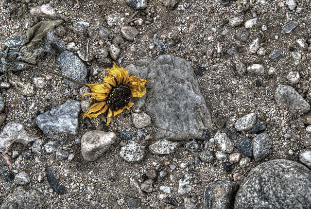
While hiking along that same road, I came upon some sunflowers in full bloom. Although it's technically winter out here, earlier in the month we were getting temperatures in the 80s. The flowers in the desert and other rural areas started blooming all over the place. This particular bloom had been picked by someone several days before I happened along the same area. It was pretty much withered up at this point, but I thought it made for an interesting photo. I've done that a couple of times, trying to make dead things look interesting. I think I succeeded with this one.
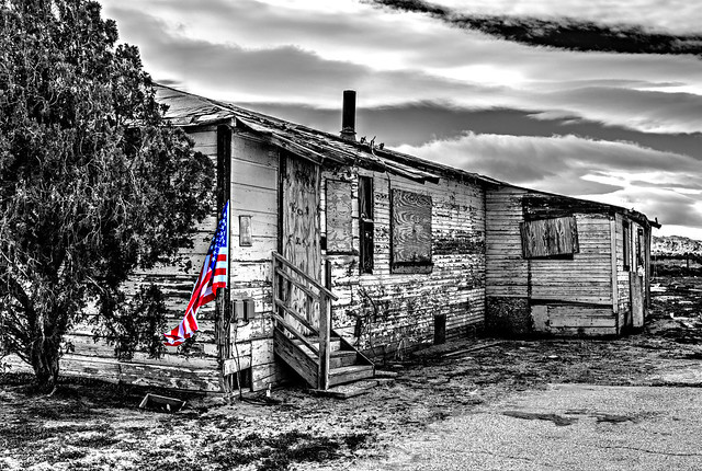
Finally, the last shot of my winter theme goes back to the first weekend in the month when I took the top two shots. I was about halfway done with my hike when I came upon this abandoned building and so I stopped to take some shots as it was a natural stopping point.
I ended up posting a full black and white version of this shot for the Sharpshooters International Photography Club weekly photo album on Facebook this past week. Someone said it probably would look even better with some selective coloring of the American Flag that was attached to the side of the building, so I decided to try it that way too. Interestingly, the flag was almost brand new, so someone had just attached it recently to the corner of the building. After looking at the two images, I think I like this one even better than the original.
And so there you have it, five photos depicting winter. Probably not the winter you have, but it's my winter and what I experienced this month. Please stop my P.J.'s page and view his shots and interpretation of winter from the state of New York. At the bottom is a link to other blogger's post on the same challenge. Thanks for stopping by.
P.J.'s Photo blogging challenge for this month was winter. Quite a few people have participated this month as I note 11 other links, plus P.J.'s own contribution to the challenge. I guess I'll be lucky number 13.
As always, winter in Southern California means something different than the rest of the country. Snow, maybe at higher elevations, but nothing here. We got a couple of days of rain in February, the latest being yesterday. It's been cold all day today, but nothing like people back east have been having. 50 degrees here would probably be a nice spring day back east.
With the nice weather, I don't have a bunch of "wintery" shots to show you. I went on a couple of nice hikes this month while out geocaching. Found some interesting abandoned buildings while out on the hike and so I thought I'd show you those.
Usually, when I write this particular blog piece, I write about individual photos, but this time, I may just keep a string of consciousness going on this one as most of the shots are very similar. The first two shots were taken while I went on a hike out in the desert north of where I live. These are included in here, mainly because both of them were accepted into the Project Weather Flickr page. Project Weather is linked up with the Yahoo Weather App. The photos that are accepted into Project Weather are then featured on the Yahoo Weather App. The first one is linked to Wilsona, CA, which means the next time it's cloudy in Wilsona, my shot could shoe up in someone's feed who happens to be looking at the weather in Wilsona. I currently have 29 of my shots in Project Weather. I see mine occasionally show up when I look at the weather for my local area since most of the shots were taken around here. I do have some that show up in other areas, particularly Grand Canyon and Bryce Canyon National Parks. The nice thing is if someone sees the shot, they can click on a small link at the bottom of the shot and the app will take the user back to my Flickr page. A little exposure never hurt anyone I guess.
Last weekend, the weather was cool, but there wasn't a threat of rain, so I went out geocaching again. I picked an area that looked fairly isolated, someplace that I hadn't been to before. What that usually means is there quite a few caches I haven't found. At one point, while searching out sites on Google maps, I spotted this area that was a paved road that turned into a dirt road. I could have driven to every one of these caches along this road, but chose to walk to them. Just seemed like it would be a waste of gas and a waste of a fairly nice cool day to spend the entire time in the car. I've been doing that a lot the last couple of months. I don't get as many caches, but I've been really enjoying the times out that I have been caching and that's what it's really all about in my opinion.
I found the sign intriguing and pretty typical of rural signs in California, perhaps elsewhere as well. They all seem to end up as targets by gun enthusiasts. Not sure why that has to happen, but it just seems like it happens more frequently than not. The cache, which was found at the base of that broken structure in the lower left hand corner of the photo was one of the ones that needed help as it was broken. I did not have an extra container with me, otherwise I might have exchanged it out. I did the best I could to keep it dry from the rain, but hopefully, the cache owner will remedy the situation so the cache continues to be viable.
While hiking along that same road, I came upon some sunflowers in full bloom. Although it's technically winter out here, earlier in the month we were getting temperatures in the 80s. The flowers in the desert and other rural areas started blooming all over the place. This particular bloom had been picked by someone several days before I happened along the same area. It was pretty much withered up at this point, but I thought it made for an interesting photo. I've done that a couple of times, trying to make dead things look interesting. I think I succeeded with this one.
Finally, the last shot of my winter theme goes back to the first weekend in the month when I took the top two shots. I was about halfway done with my hike when I came upon this abandoned building and so I stopped to take some shots as it was a natural stopping point.
I ended up posting a full black and white version of this shot for the Sharpshooters International Photography Club weekly photo album on Facebook this past week. Someone said it probably would look even better with some selective coloring of the American Flag that was attached to the side of the building, so I decided to try it that way too. Interestingly, the flag was almost brand new, so someone had just attached it recently to the corner of the building. After looking at the two images, I think I like this one even better than the original.
And so there you have it, five photos depicting winter. Probably not the winter you have, but it's my winter and what I experienced this month. Please stop my P.J.'s page and view his shots and interpretation of winter from the state of New York. At the bottom is a link to other blogger's post on the same challenge. Thanks for stopping by.
Labels:
Bryce Canyon,
challenges,
desert,
Facebook,
Flicker,
geocaching,
Grand Canyon,
hike,
Sharpshooters,
winter
Monday, February 9, 2015
Hey Butthead
Today's prompt for blogging today was: "Take a quote from your favorite movie — there’s the title of your post. Now, write!" After looking at some of the photos I took on Saturday, this particular quote from the movie Back to the Future, stood out above all the others in that movie.
Unfortunately, the desert has become for many people a dumping ground, a place to throw their unwanted crap so they can avoid paying a fee to legally dump it in a landfill. There are few times when I'm hiking and geocaching out in the desert when I can walk more than a tenth of a mile and not see some kind of refuse strewn out there.
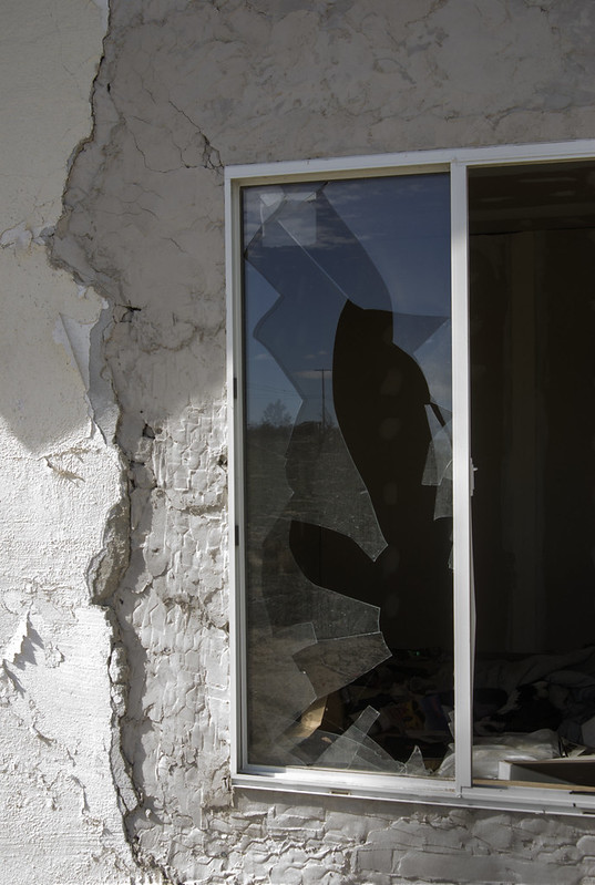
Granted, there was nothing that could be done for this one as this was a permanent structure, but if you could have seen the inside. This particular house will not surprise me in the least if sometime in the future it becomes part of an arsonist's ritual. Looking through this window, there was probably close to a foot of debris inside. I went around to the right of this shot and looked in another window and there was even more stuff in there, perfect kindling.
And if it were to happen, the house would go up and not much else. But on my hike Saturday, I also passed several other abandoned houses, plus a jacuzzi. Broken, with the insulation hanging out, someone didn't want it anymore, so instead of taking it to a landfill where it could have been disposed of properly, the owner decided to take it out and dump it in the desert.
And it goes on and on. I saw at least four chairs, two mattresses and one couch out there as well. It's interesting in a morbid sort of way too as things tend to clump together, as if they migrate to like minded junk. The chairs were all in one spot, the television and computer monitors were in a different spot out there. Oh, and let's not forget the entire load of about 25 or 30 used diapers I came upon.
And unfortunately, the title character of this blog piece just won't get it.
Labels:
desert,
environment,
geocaching,
hike,
junk,
society
Saturday, November 29, 2014
PBC (November 2014): Where the streets have no name
It's hard to believe it's the end of another month and so it's once again time for P.J.'s Photo Blogging challenge. This month's theme was "Where the streets have no name." I thought about this for a long time... well, not really that long since I live less than an hour away from an area that is huge, desolate and most of the streets have no names - the Mojave desert.
So, without further ado, here's my thoughts and photos on the theme, "Where the streets have no name."
1. Sandy, dirt road
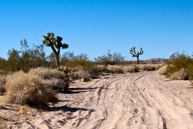
The weekends in November are usually dedicated to geocaching for me, mainly because the weather is perfect, not to hot, not really cold yet and there's an endless supply of geocaches to be found, especially out in the desert.
This particular road was one of many I've traveled on this month that has no name associated with it, although it might have a number designated. I took this shot right after we'd parked my van at the side of the road. The road was getting more and more sandy and the conditions were such that if we'd taken the van much farther in, we probably would have gotten stuck in this sand. Eventually, this road petered out entirely and turned into a river wash, so it was a very good decision on our part to hike to the last 6 caches that were out here on this "road."
2. Coyote skull
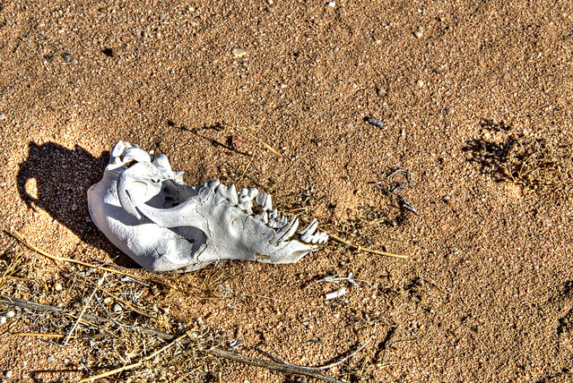
Part of the allure of the desert is that critters of any kind are rather hard to come by. However, this month while geocaching, I've seen coyote skulls and tortoise shells sans tortoises unfortunately. I've seen numerous tortoise burrows, startled jackrabbits out of their burrows while hiking through the desert and have stumbled across snakes and spiders of various sizes.
This particular skull was nicely intact and cleaned of anything that other animals might find of interest, so it was just bleaching out in the sunshine as we walked by. It's not uncommon to come across bones - the desert is a fairly harsh place - but this is probably the first time I've seen a coyote skull out there. I know they exist out in the desert as I've seen live ones from time to time.
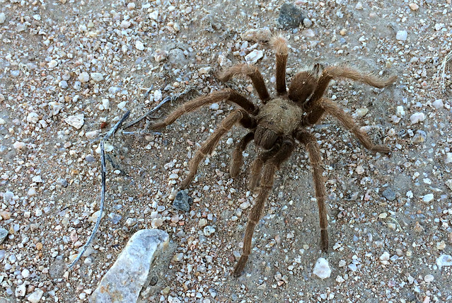
3. Tarantula
The day before Thanksgiving, my friend Craig and I decided to hike a series of geocaches out in the desert east of HWY 385, north of Victorville called the Peace Symbol. The caches are laid out to look like the cartoon hand in a V symbol for peace. If you click on the link, you'll see what I mean.
While out there, we passed several dirt roads, but had decided from the beginning that we were going to hike the entire way. We'd gotten the upper portion about 10 days before that, so it wasn't like we were going to be doing the entire thing all in one day. It took us from 8:24 in the morning, until 4:30 in the afternoon, but we hiked 14.25 miles and found 79 geocaches on the day, definitely a highlight for me hiking as I've never hiked that far or for that many geocaches all in one day.
On the way, we spotted a small gopher snake sunning itself. We took several photos of that little guy and then moved on and then as we were nearing another cache on the eastern side of the Peace symbol, I spotted this tarantula just walking along. Interestingly, it halted once we got about five feet away it and it seemed perfectly content just to stay there motionless while we took photos. Because of the length of the hike that day, I didn't bring my regular camera along. This particular shot was taken with my iPhone 5s. I'm impressed with the quality.
4. Desert storm
This particular shot was taken on November 1st well before I'd even seen the theme for this month, but I feel it tells the story of the theme nicely. I was hiking, solo this time, north of Palm Springs, California near the town of Desert Hot Springs. It was very windy, as it is most of the time in the area. The mountain passes are liberally sprinkled with windmills that generate electricity.
In Southern California, we have two deserts, the high desert and the low desert. This area is in the low desert. Sparser vegetation is usually the key, but it also has to do with elevation. Once you start seeing Joshua Trees (see the first shot above), you're probably in the high desert.
Palm Springs is in the low desert and gets less rainfall than the high desert does, which is one of the reasons there is less vegetation. Not on this day however as that storm more quickly through the area and dropped rain hard and fast. Out hiking, the best I could do was put my camera under my sweatshirt and move as quickly as I could from cache to cache. I couldn't stay dry, because the wind was blowing hard enough that the raindrops were pretty much moving horizontally. Once I got back to my car, which was parked alongside a nameless dirt road, the westward side was totally wet and clean, while the east facing side of the van was dry as a bone.
5. A circular road
Most people recognize the circular nature of the seasons. I look at it as a road we travel through life. Each one's road is slightly different depending upon their perspective. Here in Southern California, one of the hottest months of the year is September and that heat, sometimes triple digits, can persist into October. We've been having 80 degree weather this entire Thanksgiving week.
No, I'm not trying to rub it in, just pointing out the differences in our roads. Back east, fall starts the leaves turning sometimes as early as late August. Out here, our leaves have started to turn, but will continue to turn throughout much of December and January. I have a deciduous tree in my back yard that for the last couple of years has not shed its leaves. Go figure that one out.
I actually thought about using this shot while I was on my morning bike ride and heard a song entitled "Roads" by Chris Mann.
There are roads in this life that we all travel
There are scars and there are battles where we roam
When we are lost or wherever we may go
They will always lead you home
There are roads that have led me to another
To a friend or to a lover I have known
For every turn is a year that I have grown
As I walk along these roads
And so ends another entry in the photo blogging theme, "Where the streets have no name." I hope you have enjoyed these shots. Please stop by P.J.s blog and scroll down to the bottom to see a list of other bloggers who have taken on this theme as well.
An aside to P.J. You asked whether you'd like me to guest blog on your site and the answer is yes if you'd like to use that piece I wrote, I'd be happy guest post. For some reason, the reply function is working over here, so I figure I'd let you know this way.
So, without further ado, here's my thoughts and photos on the theme, "Where the streets have no name."
1. Sandy, dirt road
The weekends in November are usually dedicated to geocaching for me, mainly because the weather is perfect, not to hot, not really cold yet and there's an endless supply of geocaches to be found, especially out in the desert.
This particular road was one of many I've traveled on this month that has no name associated with it, although it might have a number designated. I took this shot right after we'd parked my van at the side of the road. The road was getting more and more sandy and the conditions were such that if we'd taken the van much farther in, we probably would have gotten stuck in this sand. Eventually, this road petered out entirely and turned into a river wash, so it was a very good decision on our part to hike to the last 6 caches that were out here on this "road."
2. Coyote skull
Part of the allure of the desert is that critters of any kind are rather hard to come by. However, this month while geocaching, I've seen coyote skulls and tortoise shells sans tortoises unfortunately. I've seen numerous tortoise burrows, startled jackrabbits out of their burrows while hiking through the desert and have stumbled across snakes and spiders of various sizes.
This particular skull was nicely intact and cleaned of anything that other animals might find of interest, so it was just bleaching out in the sunshine as we walked by. It's not uncommon to come across bones - the desert is a fairly harsh place - but this is probably the first time I've seen a coyote skull out there. I know they exist out in the desert as I've seen live ones from time to time.
3. Tarantula
The day before Thanksgiving, my friend Craig and I decided to hike a series of geocaches out in the desert east of HWY 385, north of Victorville called the Peace Symbol. The caches are laid out to look like the cartoon hand in a V symbol for peace. If you click on the link, you'll see what I mean.While out there, we passed several dirt roads, but had decided from the beginning that we were going to hike the entire way. We'd gotten the upper portion about 10 days before that, so it wasn't like we were going to be doing the entire thing all in one day. It took us from 8:24 in the morning, until 4:30 in the afternoon, but we hiked 14.25 miles and found 79 geocaches on the day, definitely a highlight for me hiking as I've never hiked that far or for that many geocaches all in one day.
On the way, we spotted a small gopher snake sunning itself. We took several photos of that little guy and then moved on and then as we were nearing another cache on the eastern side of the Peace symbol, I spotted this tarantula just walking along. Interestingly, it halted once we got about five feet away it and it seemed perfectly content just to stay there motionless while we took photos. Because of the length of the hike that day, I didn't bring my regular camera along. This particular shot was taken with my iPhone 5s. I'm impressed with the quality.
4. Desert storm
This particular shot was taken on November 1st well before I'd even seen the theme for this month, but I feel it tells the story of the theme nicely. I was hiking, solo this time, north of Palm Springs, California near the town of Desert Hot Springs. It was very windy, as it is most of the time in the area. The mountain passes are liberally sprinkled with windmills that generate electricity.
In Southern California, we have two deserts, the high desert and the low desert. This area is in the low desert. Sparser vegetation is usually the key, but it also has to do with elevation. Once you start seeing Joshua Trees (see the first shot above), you're probably in the high desert.
Palm Springs is in the low desert and gets less rainfall than the high desert does, which is one of the reasons there is less vegetation. Not on this day however as that storm more quickly through the area and dropped rain hard and fast. Out hiking, the best I could do was put my camera under my sweatshirt and move as quickly as I could from cache to cache. I couldn't stay dry, because the wind was blowing hard enough that the raindrops were pretty much moving horizontally. Once I got back to my car, which was parked alongside a nameless dirt road, the westward side was totally wet and clean, while the east facing side of the van was dry as a bone.
5. A circular road
Most people recognize the circular nature of the seasons. I look at it as a road we travel through life. Each one's road is slightly different depending upon their perspective. Here in Southern California, one of the hottest months of the year is September and that heat, sometimes triple digits, can persist into October. We've been having 80 degree weather this entire Thanksgiving week.
No, I'm not trying to rub it in, just pointing out the differences in our roads. Back east, fall starts the leaves turning sometimes as early as late August. Out here, our leaves have started to turn, but will continue to turn throughout much of December and January. I have a deciduous tree in my back yard that for the last couple of years has not shed its leaves. Go figure that one out.
I actually thought about using this shot while I was on my morning bike ride and heard a song entitled "Roads" by Chris Mann.
There are roads in this life that we all travel
There are scars and there are battles where we roam
When we are lost or wherever we may go
They will always lead you home
There are roads that have led me to another
To a friend or to a lover I have known
For every turn is a year that I have grown
As I walk along these roads
And so ends another entry in the photo blogging theme, "Where the streets have no name." I hope you have enjoyed these shots. Please stop by P.J.s blog and scroll down to the bottom to see a list of other bloggers who have taken on this theme as well.
An aside to P.J. You asked whether you'd like me to guest blog on your site and the answer is yes if you'd like to use that piece I wrote, I'd be happy guest post. For some reason, the reply function is working over here, so I figure I'd let you know this way.
Labels:
animals,
challenges,
desert,
fall,
geocaching,
hike
Subscribe to:
Posts (Atom)